|
 |
|||||||||||||||||||||||||
|
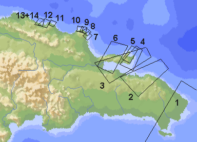
Aerial Photo Special: The Northcoast of the Dominican Republic On November 24th, 2000 we had the pleasure of sitting in the cockpit during the approach to Puerto Plata and being allowed to take pictures. As we had been on a southern course we descended along the dominican northcoast. On the map you can see, where the pictures where taken. The first picture was taken just before we started our descend from 35000ft, Nr. 8 and 9 from about 10000ft. |
|||||||||||||||||||||||||
 |
|||||||||||||||||||||||||
 |
|||||||||||||||||||||||||
|
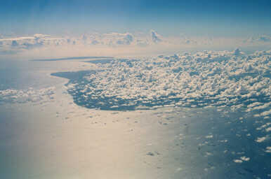
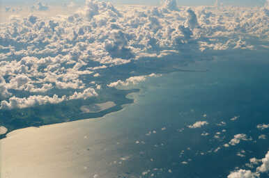
1: The Dominican Eastcoast: Punta Cana in the front, Isla Saona at the horizon. |
|||||||||||||||||||||||||
 |
|||||||||||||||||||||||||
|
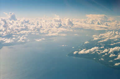
2: East of the bay of Samana, in the front Laguna Redonda. |
|||||||||||||||||||||||||
 |
|||||||||||||||||||||||||
|
3: Samana Bay |
|||||||||||||||||||||||||
 |
|||||||||||||||||||||||||
|
4+5: The eastern tip of the Samana peninsula: Right (below) Las Galeras, further to the right Playa del Rincón. |
|||||||||||||||||||||||||
 |
|||||||||||||||||||||||||
 |
|||||||||||||||||||||||||
|
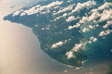
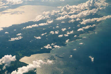
6: Further along the peninsula to the west, in the background Samana Bay. |
|||||||||||||||||||||||||
 |
|||||||||||||||||||||||||
|
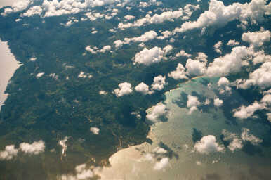
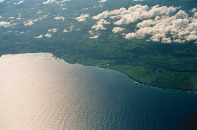
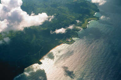
7: Between Cabrera and La Entrada, in der middle Playa Diamante. |
|||||||||||||||||||||||||
 |
|||||||||||||||||||||||||
|
8: Cabrera |
|||||||||||||||||||||||||
 |
|||||||||||||||||||||||||
|
9: Abreu, right the Hotel Eden Bay (Bello Mar). |
|||||||||||||||||||||||||
 |
|||||||||||||||||||||||||
|
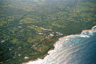
10: Playa Preciosa, Playa Grande, Hotel Caribbean Village Playa Grande and the golfcourse. |
|||||||||||||||||||||||||
 |
|||||||||||||||||||||||||
|
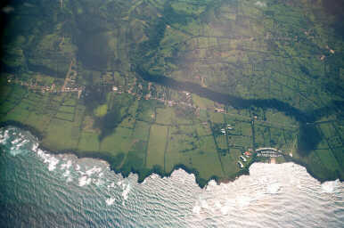
11: Hotel LTI Sol de Plata between Cabarete and Sosua. |
|||||||||||||||||||||||||
 |
|||||||||||||||||||||||||
|
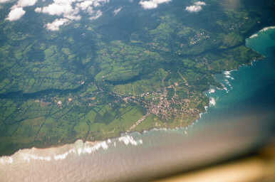
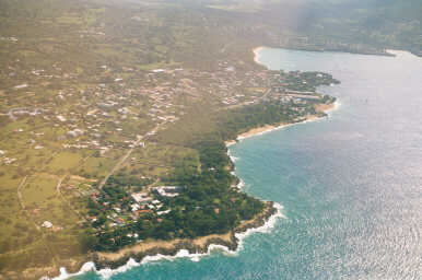
12: Sosua |
|||||||||||||||||||||||||
 |
|||||||||||||||||||||||||
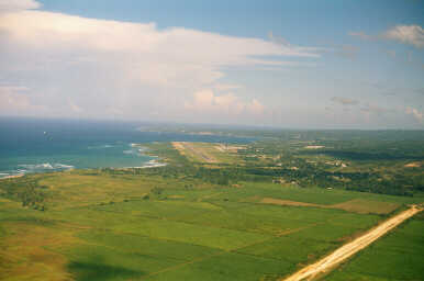
|
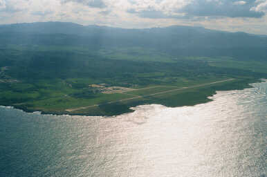
13 + 14: Airport Puerto Plata |
|||||||||||||||||||||||||
 |
|||||||||||||||||||||||||